Falls of Whiteoak Canyon
| Driving Directions | From the Top The parking area is on the east side of Skyline Drive at milepost 42.6. From the Bottom To reach the SR 600 parking area, go south on US 522 0.8 mile from the intersection of US 211 and US 522 south. Turn right on VA 231, go 9.5 miles to SR 643. Turn right, come to SR 600 after about 4.5 miles. Turn left and go less than 5 miles to the end of the road and the parking lot. |
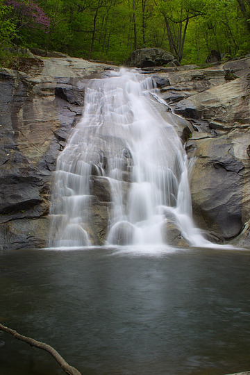
1
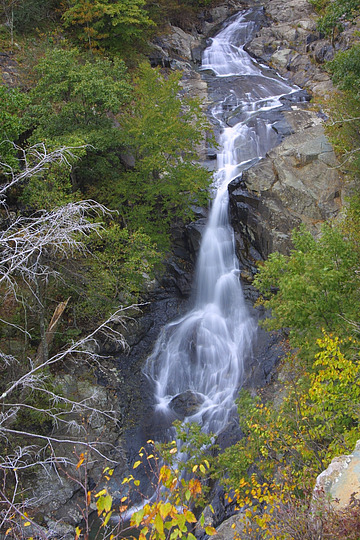
Like some other waterfalls in the Shenandoah, this one is best viewed from the high cliff overlook, to fully take in the wide canyon.
| River | Whiteoak Run |
| Height | 86 feet |
| Walking Directions | Distance: 2 miles, 600 feet downhill From the parking area off the Skyline Drive (milepost 42.6, on the east side), take the "Whiteoak Canyon Trail" for about 2 miles. You will pass three intersections with other trails and fire roads, and a bridge over the stream. Just above the falls is a bridge over Whiteoak Run. Soon after crossing the bridge the trail splits into three: a ford to the right, the horse trail to the left, and the canyon trail straight ahead. Take the canyon trail to a high cliff overlook of the waterfall. |
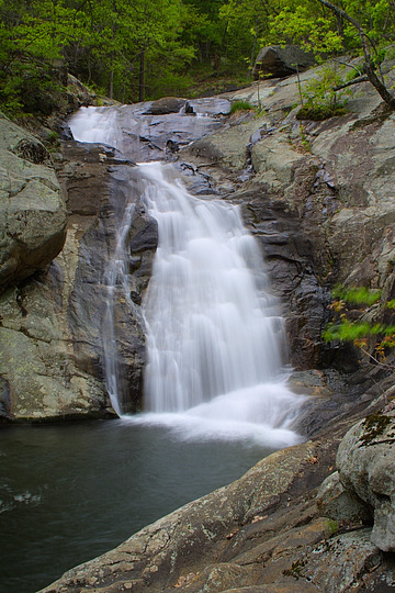
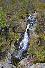 | Wider view showing more cascades at the top. |
2
| River | Whiteoak Run |
| Height | 50 feet |
| Walking Directions | This fall is located just downstream from Whiteoak Falls 1. Continue on the trail down from the overlook (or up from Fall 3); the waterfall is easily seen from the trail. |
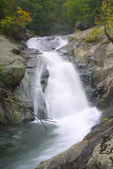
3
| River | Whiteoak Run |
| Height | 36 feet |
| Walking Directions | Like Whiteoak Falls 1, this fall is most easily seen from a high cliff overlook directly on the Whiteoak Canyon Trail. You can't miss it. |
4
| River | Whiteoak Run |
| Height | 40 feet |
5
| River | Whiteoak Run |
| Height | 51 feet |
| Walking Directions | Follow the directions to Whiteoak Falls 6.
Continue on the trail up to the second switchback above fall 6; when the
trail heads back towards the stream to make the turn, there is a large
boulder. A narrow side trail (not maintained) heads straight ahead to the left
of the boulder.
Note that the first switchback above fall 6 also has a boulder where the
trail turns.
The path leads to the top of fall 6; follow the path upstream to fall 5. |
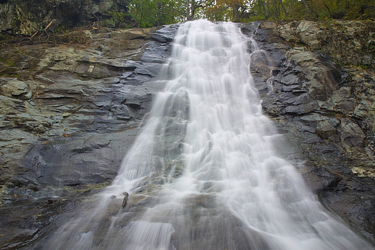
6
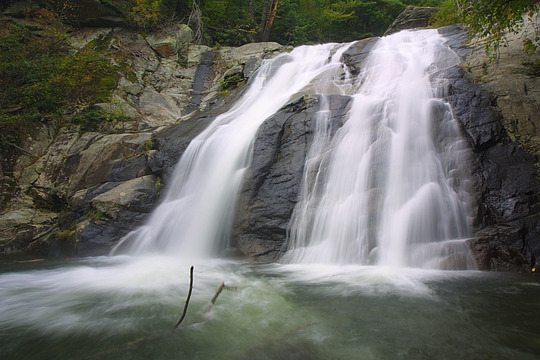
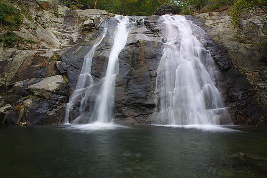
Whiteoak Run splits into two just before sliding down this smooth, 50 foot cliff. Like the other waterfalls in Whiteoak Canyon, the trees surrounding the stream allow photographs without sky.
| River | Whiteoak Run |
| Height | 50 feet |
| Walking Directions | This is the last (major) waterfall in Whiteoak Canyon. The trail connects the
Skyline Drive to a parking area and entrance station on SR 600, just outside
the park. This fall is about 4 miles from the Skyline Drive (with 1800 feet
of elevation change), and about 1.5 from the SR 600 parking area.
The waterfall is right beside the trail, and should be impossible to miss
from either direction.
The trail from the lower parking area soon crosses a bridge. Shortly after the bridge, the trail forks. The right fork leads to Whiteoak Canyon. |
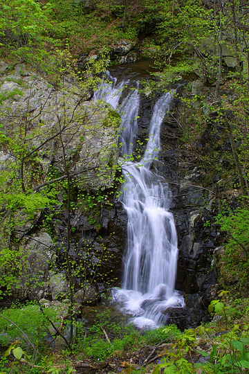
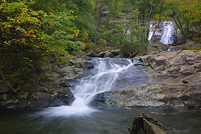 | A small cascade just downstream from Whiteoak Canyon Falls 6. |